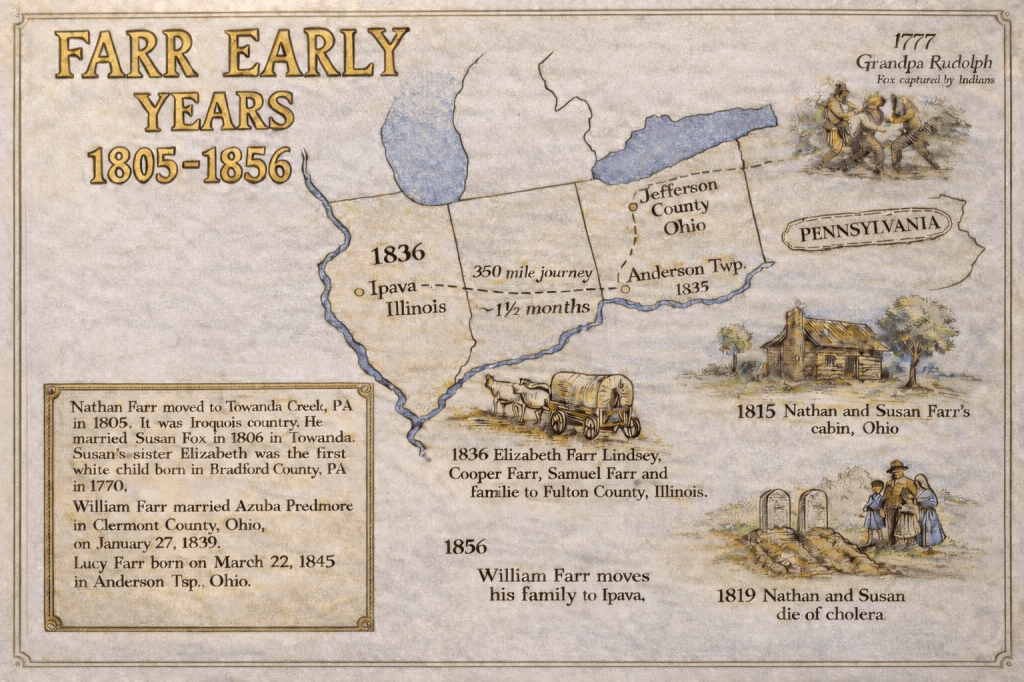
The Farr Family migrated from Ohio to Illinois in the late 1830s. Four siblings and their families move west in two groups. In 1836, Elizabeth Farr Lindsey, Cooper Farr and Samuel Farr and their families left Ohio and moved to Fulton County, Illinois. Their brother William Farr and his family remained in Anderson Township, Ohio until 1853 and then he and his family also moved to Fulton County, Illinois. The starting point for these pioneers moving to Illinois was — Anderson Township, Ohio (near Cincinnati): Generally, families such as the Farr’s and Lindsay’s would leave from the Cincinnati area normally heading northwest or west to pick up the region’s main wagon arteries rather than attempt long, difficult upstream river travel.
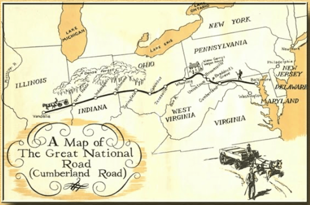
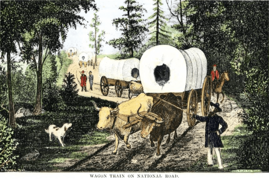
The main highway was the National Road which was the big east–west wagon/coach artery by the 1830s. The National Road had been pushed across Ohio and Indiana and was open into Illinois to Vandalia by 1839. Wagon parties from Ohio commonly used sections of that road through Ohio → Indiana → into Illinois because it was the best-maintained, most direct overland route. A family leaving Anderson Township would head to the nearest connecting feeder road and join the National Road route westward through central Indiana near Indianapolis and Terre Haute into Illinois and on to the Vandalia area.
Once in Illinois, the Farr’s would approach Fulton County from the National Road’s western end in Vandalia, Illinois. Pioneer travelers would turn onto local prairie roads and county routes heading north and west toward Fulton County (Lewistown/Canton/Ipava area). By the 1840s–1850s those local roads were used frequently by settlers moving into central and west-central Illinois; county atlases and plat maps show the developing road network into Fulton County.
The National Road was the main federal wagon highway and reached Vandalia, Illinois, in the 1830s — settlers used it for westward moves in the 1830–1850s.
Step-by-step route along the National Road from Ohio across Indiana to Fulton County, Illinois
Map of the National Road by Bill Smith
1. Anderson Township → Cincinnati area (The Journey Begins)
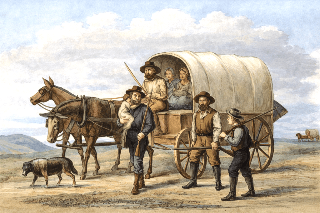
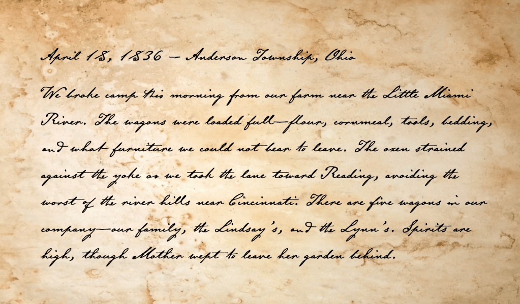
- The family group of the Farr’s, Lindsay’s and Lynn’s began their move to Illinois on local township or county roads heading northwest toward Cincinnati to join major regional roads.
- Wagons avoided steep hills near the Ohio River when possible, so they might head toward Reading before turning west to get to the National Road, the first Federal highway in the United States.
2. Cincinnati → Dayton or Springfield
- From Cincinnati, they’d likely took the Hamilton–Eaton–Dayton Road, a common emigrant route leading toward Dayton or Springfield, Ohio.
- These towns were hubs connecting to the National Road (which ran through Springfield, 50 miles west of Columbus).

Picture of the National Road by North Wind Picture Archives.
3. Springfield → Indianapolis (via the National Road)
- The little party of settlers joined the National Road (today U.S. 40) heading west through Springfield, Ohio, crossed the state line at Richmond, Indiana and passed through Cambridge City and Indianapolis, Indiana. This section of the National Road was heavily traveled by settlers moving west. Inns, blacksmith shops, and feed stops lined the road.
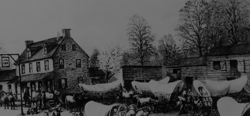
Stop on the National Road.
4. Indianapolis → Terre Haute → Vandalia (Illinois)
- They continued west on the National Road through: Plainfield, Greencastle and Terre Haute, Indiana. Then they crossed the Wabash River into Illinois passing through Marshall, Effingham and finally Vandalia, Illinois which was the National Road’s terminus in the 1830s – 1840s.

5. Vandalia → Fulton County (northwest route)
- At Vandalia, the Farr’s would leave the National Road and head northwest on regional wagon roads toward the Illinois River valley, possibly going through Hillsboro, Jacksonville or Beardstown. At Beardstown, they crossed the Illinois River. Almost at the end of their journey, they would follow local roads west/northwest to Fulton County and Ipava.

- The estimated distance from Anderson, Ohio to Ipava, Illinois was about 375 to 400 miles. Typically families on wagons could travel 10 to 15 miles a day meaning the journey took 4 to 6 weeks of travel depending on weather and road conditions.
